 Lisa Watson")
The Daluis Gorge. Photo Lisa Watson.
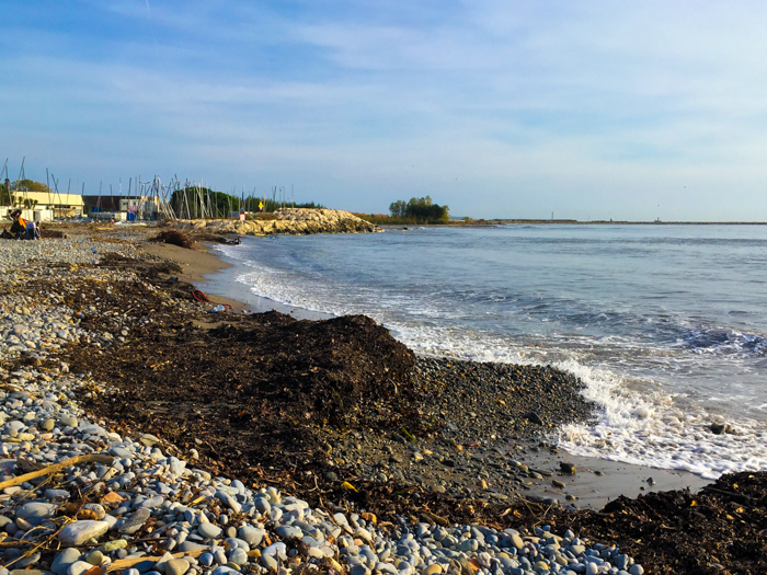
I stood on the stony beach of the Riviera in the hot morning sun, watching the seagulls bobbing on the waves where the waters of the Var River flow gently out of its wide mouth to mingle with the salty Mediterranean Sea. All was quiet. It was too early in the day for the holiday beach-goers to be up. Suddenly, the seagulls lifted into the air as one, screeching loudly in protest as a large plane flew just over their heads and touched down on the Nice airport runway on the opposite bank of the river of the river.
I hadn’t come to watch the planes but to contemplate the river at its endpoint. The Var River had intrigued me since I moved to the Cote d’Azur many years ago, as I often crossed it when driving from my home in the hills behind the coast on my way to Nice or to Italy to visit my parents-in-law. From where in the Alps did it flow? Why is it called the Var when it does not flow through the region by the same name? On this hot summer day, tempted by the cooler climate of the mountains behind the city, I set out to follow it upstream in search of answers and adventure.
“This great madman, fit for nothing and incapable of being brought to its senses.” That was how Marquis Sébastien Le Prestre de Vauban, one of the most celebrated civil engineers in the history of France, described the 125-kilometer (78-mile) run of the Var River back in the 17th century. Its course has been partially tamed by dams and dikes over the centuries, but the Var still has a tumultuous history of disastrous flooding. In 1996 this deceptively calm river rose so quickly that the resulting floodwaters killed seven people and caused catastrophic damage to property and land along its length.
Nice and surroundings have been fully part of France since 1860. Previously, the area had various masters (Provence, Savoy, Sardinia, briefly France). At times, the Var River served as a natural border between ruling parties. A possession of the Kingdom of Sardinia in the mid-19th century, Nice and surroundings, were transferred to France, then under Napoleon III, in exchange for France’s military aid in keeping Austrian forces out of the Italian states. The Savoy region further north along the Alps was also embraced by France (and vice versa) at the time. Before the exchange, the Var territory stretched further to the east than it does now, bordering the river that gave it its name. The border of the department of Var is now drawn further west, leaving the Var River to run mostly through the department of Alpes-Maritimes, with a twist through Alpes-de-Haute-Provence, as it reaches Entrevaux.
Entrevaux
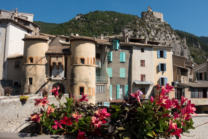
Leaving the stony beach and harried seagulls behind, I followed the road that mirrors the flow of the river, towards the Alps, now the formidable border between France and Italy. At the beginning of the drive, the river and road cuts through the middle of a wide plain corralled by steep hills on either side. Occasionally, the road passes through sleepy, candy-colored villages shaded by plane trees. Just over an hour’s drive from Nice, the medieval village of Entrevaux looms into view.
Entrevaux clings to the side of a steep rocky outcrop, protected on three sides by the swirling river. The only feasible entry to the pedestrian village is via an ancient stone bridge arching high above the turbulent waters, and through a menacing portcullis that was built to keep invading hordes out of the village streets and protect the castle perched high on the promontory above. The walk up to the castle starts from the cliff side of the town by way of a cobbled path of unshaded switchbacks. I trudged upwards in the summer heat, wishing fervently that I had brought a bottle of water. The exploration of the half-ruined castle and the spectacular views up and down the Var Valley made the hike to the top very much worth it.
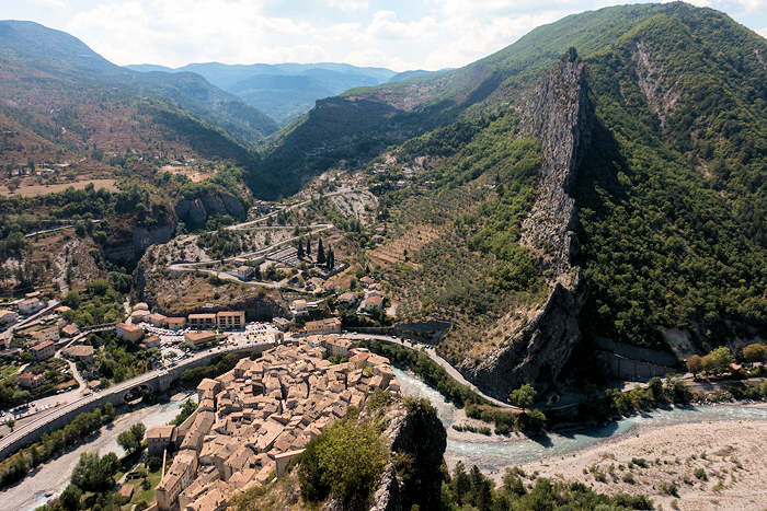
The Daluis Gorge
After a rejuvenating ice cream and now armed with a large bottle of water, I returned to the car to continue the drive alongside the river. Just a five-minute drive further up the valley from Entrevaux lies the hidden entrance to the Daluis Valley. A road sign points into a tunnel chipped out of a rock wall, where the river makes a sudden right-hand turn through a narrow cut in the seemingly impenetrable cliff. As I emerged from the unlit tunnel, the valley opened out before me like a verdant Land of the Lost, with the sparkling river bordered on either side by empty green fields and steep tree-covered hills. The road then winds up into the mountains following the river and passing through the stunning, narrow Daluis Gorge. On entering the gorge, the rocks and even the road itself become a dark red color in this area formed 250-million years ago from iron-rich volcanic ash.
I stopped at the Berthéou Bridge and set out to search for a viewpoint where I could eat my picnic lunch. After a short hike over purple and red rocks, I came to the aptly named Point Subline outlook. The cliff here juts out into the gorge to give a stunning view of the entire valley from the mountain peaks at one end to the grassy plains at the other. I cautiously approached the guard-rail and peered over it to the churning river hemmed in by steep dark walls far below. After backing gingerly away from the vertiginous drop, I settled myself on a large rock and ate my sandwich while studying the vertical wall across the valley, trying to spot all the dark mouths of the mine entrances vertiginously cut into the rock walls hundreds of meters above the valley floor. From prehistoric times to the early 20th century, people risked their lives digging for copper and other sought-after minerals here, using ladders and ropes to scale the cliffs to mines that are no longer accessible.
Discovering The Source
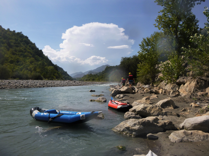
As I travelled further up the valley and into steeper mountain terrain, the Var River became smaller, constrained by its surroundings to create waterfalls that led it on its downward path toward the sea.
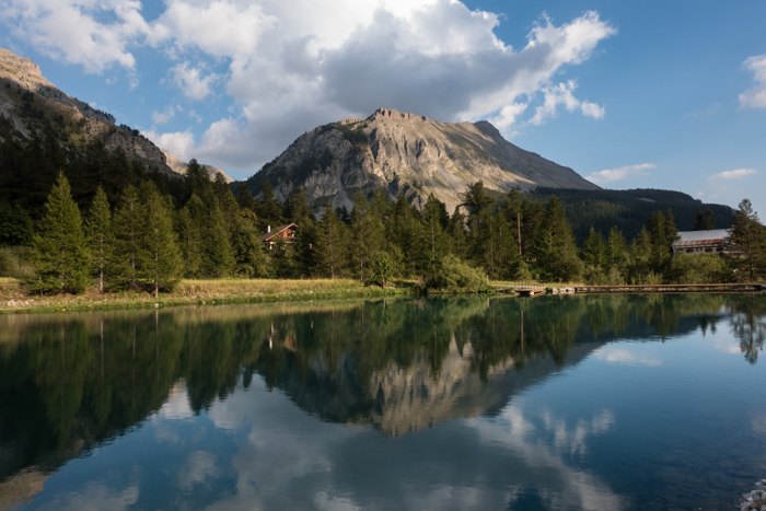
In the late afternoon, I finally arrived at Estenc, a tiny village nestled at the end of the valley just below the 2,326-meter (7631-foot) high Cayolle Pass. Enjoying the cool mountain air, I walked along a signposted trail to a pretty lake, then with mounting excitement to the source of the Var just beyond the lake. I pushed through some bushes and came face to face with a very small, muddy pool leaking brackish water.
The sight was underwhelming yet it was accompanied by the great pleasure of knowing that that this humble beginning is the start of a powerful river that has had such a huge impact for centuries on the people and landscape along its length.
I stared at the mud puddle for a few minutes, then walked back to the quaint 2-star Relais de la Cayolle, the only hotel in Estenc. There, I enjoyed a hearty dinner of coq au vin and zucchini gratin, before settling in for the night. I was lulled to sleep by a silence broken only by the occasional owl hooting and the splashing of the Var River as it begins its journey through the valley and down to the coast.
If you go
Relais de la Cayolle, Route des Grandes Alpes, Hameau d’Estenc, 06470 Etraunes. The hotel has no website. To reserve a room and/or book a table at the restaurant call +33 (0)4 93 05 51 33.
For those without a car, it is possible to enjoy the rugged and spectacular views on a day trip into the Riviera’s back-country from Nice to Entrevaux on the Train des Pignes. See the official website of the Pignes tourist train for information for schedules and prices.
Text and photos © 2022, Lisa Watson.