A photolog of a 3-day stay in Normandy, destination the Landing Zone, for a D-Day tour including stops at Pegasus Bridge, Juno Beach, Arromanches, Bayeux, the La Cambe German Cemetery, Sainte Mere Eglise, Pointe du Hoc, Omaha Beach and the Normandy American Cemetery.
U.S. President Obama, French President Sarkozy, English Prime Minister Brown, and Canadian Prime Minister Harper visited the Landing Zone in Normandy on Saturday but I beat them to the punch, spending a few days there earlier in the week before the crowds arrived. The photo log below shows many (but not all) of the main D-Day sights and cemeteries that one can see over about three days if setting out from Paris.
In a separate article I outline a series of possible itineraries for visiting the D-Day Landing Beaches of Normandy, but for now I invite you to join me on a portion of my own itinerary last week.
I lucked upon a string of sunny days, hence the blue skies in the photos, which is a rarity in Normandy, as anyone who has read about the events of June 1944 knows. Though my own trip also included a visit to Deauville and Honfleur before visiting the Landing Zone and Le Mont Saint Michel, Saint Malo, Le Mans, and Chartres afterwards, this photo log focuses on sights along and inland of the Landing Zone of June 6, 1944.
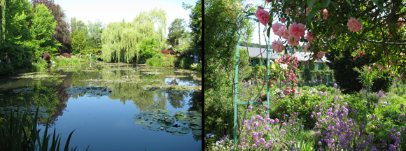
However, I can’t help but begin with images of Monet’s Garden and House at Giverny since it’s only a slight detour on the way to Normandy. In a sense, the day was too blue when I took the picture below left of Monet’s water lily pond since there was nothing in the sky to be reflected in the water as there often was in Monet’s work. The garden, below right, was in full bloom.
The road to Normandy from Paris more or less follows the Seine downstream towards the English Channel. After Giverny I backtracked upstream along the river to visit La Roche Guyon. I planned it that way because if visiting both it’s advisable to arrive early at Giverny. Furthermore, La Roche Guyon makes for a better lunch stop between the two.
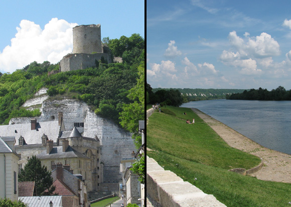
La Roche Guyon naturally rings far fewer bells than Giverny, but it’s an interesting stop for a WWII tour because the chateau in the photo below left is where German Field Marshall Rommel set up his headquarters when he was appointed by Hitler to oversee and reinforce defenses along the Atlantic Wall. Many of the Landing sights that you’ll see in Normandy were personally inspected by Rommel from January to May 1944. The chateau of La Roche Guyon has a 1000-year history that I won’t go into here. The main marks from Rommel’s period are the casements where ammunition was kept, which now present an exhibit about that period. Otherwise, the chateau is a wonderful mishmash of periods with a beautiful view over the Seine. I typically think of Giverny as a pain for a daytrip on its own from Paris, but I do like the idea of a day combining Giverny with La Roche Guyon, though it’s necessary to have a car to do so or good biking legs from Vernon. La Roche Guyon is a pretty Seine-side town. The photo below right is a view upstream from the town.
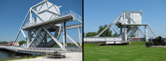
Approaching the D-Day sights from the east, i.e. with the British and Canadian Landing Beaches, the first stop is Pegasus Bridge, which was rapidly taken by British airborne troops arriving in three gliders on the night of June 5-6, 1944. The bridge was taken in order to cut off German troops—and especially tanks—that might arrive from further east once the landing started and to prevent them from crossing the Orne River. The bridge that now goes over the Orne (below left) is a higher tech replica of the original bridge, which has been moved onto the grounds of the Pegasus Memorial Museum a few hundred yards away, which tells about the British airborne landing.
The Merville Battery was also captured by British airborne troops arriving by parachute and glider on the night of June 5-6, 1944. This was a major German battery between the coast and the right bank of the Orne whose guns were capable of firing on Sword Beach, the easternmost of the Landing Beaches. I won’t tell here the heroic and bloody story of how it was taken, but I will say that after reading about it and visiting the site several times before I was fortunate to hear first-hand last week when I met Alexander Taylor, who landed on a glider that night.
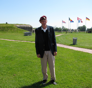
The Landing Zone is worth a visit at any time of year, but those who visit in the days surrounding June 6 may well encounter visiting some of the men who took part in the landing. During the 20 or times that I’ve visited the Landing Zone, beginning in 1992, I’ve had the opportunity to speak with visiting veterans on various occasions, but this is the first time I actually stood at the very spot where a man landed on D-Day and had him describe the event to me as he lived them. When I asked him his name also told me his dog tag number, 22543202. Here is Alexander Taylor, 22543202 standing tall at the Merville Battery, which he helped capture and render unusable at the age of 20.
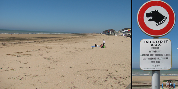
I am sorry to say that I gave the Canadians short shift on this visit. Though I did stop at Juno Beach (where pit bulls and rottweilers are not allowed, I note in case you were planning on traveling with one), I didn’t visit the June Beach Center, Canada’s Second World War museum, which is by the beach at Courseulles-sur-Mer. Nor did I visit the Canadian Cemetery, which is a few miles inland at Riviers. Apologies to my Canadian readers. If anyone has a photo of the Canadian Cemetery I would like to post it here.
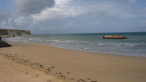
Arromanches is the town at the center of Gold Beach. It was here that the British built the artificial harbor known as a Mulberry. Some remnants of the harbor still remain just offshore. (The photo below, with clouds, was one that I took last year on June 6.) The D-Day Museum at Arromanches shows how the harbor was built and how it operated, along with other displays about the landing and the various nationalities that took part.
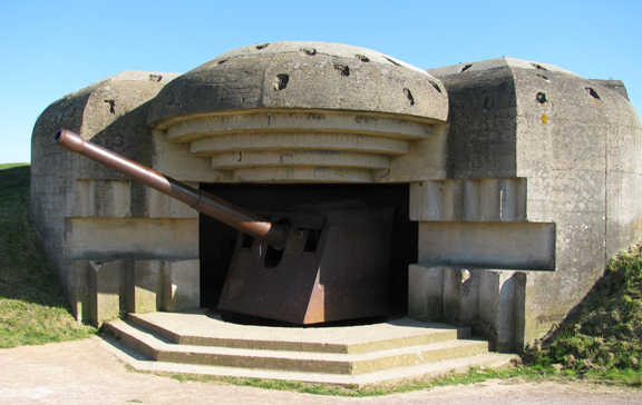
The only German battery along this coast with its canons still visible are those at Longues-sur-Mer. The photo below is one of four 155mm gun emplacements at Longues that were a danger to the landing of British troops at Gold Beach as they could fire up to 12 miles. Visiting the complex you’ll also see the position of its command center by the cliff and other concrete elements of the Atlantic Wall. Three of the four canons were put out of commission by naval fire within the first hour of the landing, but one was occasionally operational until about 5 p.m. The garrison here of 184 Germans surrendered to the British the following day.
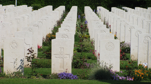
Americans tend to visit only the American Cemetery but I think it’s important to visit those of other nationalities so as to have a sense not only of their loss and sacrifice but of their approach to their war dead. Here’s a section of the British Cemetery at Bayeux.
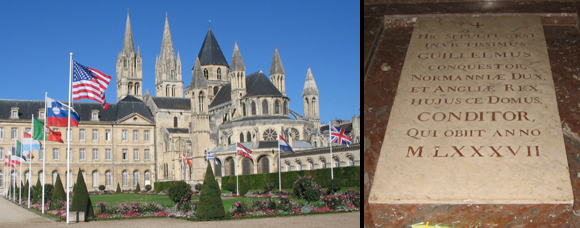
The American connection with Normandy begins with D-Day, but the British connection goes back much further, beginning with William the Conqueror, Duke of Normandy, who took the crown of England after the Battle of Hastings in 1066. William is buried at the Abbaye aux Hommes (Men’s Abbey) at Caen.
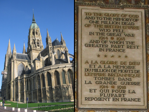
The tapestry was made in about 1080 to be hung during Christmastime in the Cathedral of Bayeux. Inside the cathedral a plaque honors British troops who fought in the WWI.
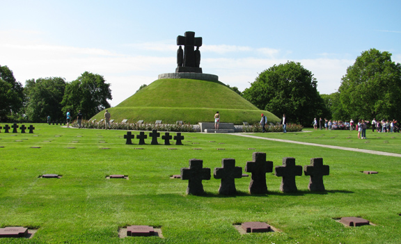
In visiting the American sector, i.e. Utah and Omaha Beaches and related sights, I generally recommend starting out to Utah Beach, the westernmost beach, then visiting your way back towards Omaha rather than the other way around. On the way to Utah you might first stop, as I did, at the German Cemetery by the village of La Cambe. This cemetery contains the largest number of dead of all of the cemeteries in the region, over 21,000, including 207 unknown soldiers buried beneath the mound that dominates the cemetery.
I neglected to take any pictures at Utah Beach but here are pictures of the nearby village of Sainte-Mère-du-Mont, right, where men and women were playing soldier and parading around with their wartime jeeps. You’ll come across these collectors (I suppose that’s the word for them) at any time of year but especially around the anniversary of D-Day. Hundreds were gathering for the 65th anniversary this weekend. Few of them are American or British. I mostly heard French and Dutch last week.
I was in a little bar in Port-en-Bessin one evening when a jeep sporting a U.S. flag parked right out front. Out popped a big man with a long gray beard and a short plump women, both dressed in U.S. army uniforms, looking like Mr. and Mrs. Claus on a Bob Hope special. They entered the bar and the man demanded beer. That’s all he said, “Beer,” and he held one hand about 18 inches above the other to show that he wanted it big. The bartender asked where he was from. He said, “Czechoslovakia,” and he meant it.
The photo bottom right is of Sainte-Mère-Eglise, the town taken by American airborne troops on the night of June 5-6 and securing the bridges and roads of the western edge of the Landing area. The parachute hanging from the steeple is a wink to paratrooper John Steele who got stuck there. The Airborne Museum at Sainte-Mère-Eglise is quite good and has an excellent introductory film to both the overall landing operation and the specific events in and around Sainte-Mère-Eglise.

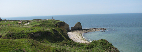
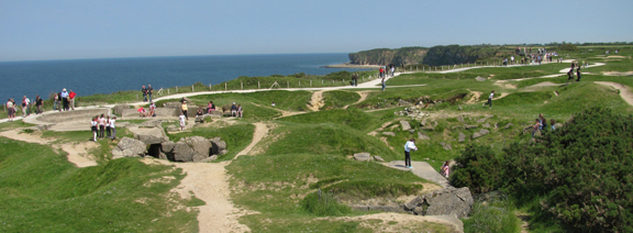
The guns at Pointe du Hoc were a danger for the landing at the two American beaches, Utah and Omaha, and even though the Rangers who climbed the cliff discovered to their surprise that the guns had been moved inland and weren’t operational, the site is nevertheless one of the most dramatic of those in the Landing Zone. In addition to the drama of the events of June 6-8, 1944 that took place here as the Rangers took and held the battery, the site also reveals the construction and workings of the German battery complex and the extent to which it was bombed. The bomb craters here, unlike most craters elsewhere along the coast, have not been filled in. The top photo below shows the Pointe du Hoc and the cliff that the Rangers scaled. The bottom photo shows some of the bombed out landscape.
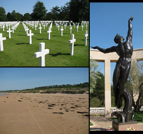
The American Cemetery is about 15 minutes east along the coast from Pointe du Hoc. The cemetery overlooks Omaha Beach, the bloodiest of the five Landing Beaches. I’ll be writing about Omaha Beach, the cemetery, and all else that’s mentioned above in a separate article. For now I just point out the three images below: a view of the cemetery (top left), the memorial to American youth rising from the waves (right), and Omaha Beach (bottom left).

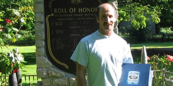
As noted above regarding Alexander Taylor, 22543202, encountering men and women somehow related to the events of the war—whether veterans, their children, Normans who lived through it or their children—is enormously enriching in exploring this zone. Below is a photo of Bernard Lebrec, whose apple farm produces the three main alcoholic beverages produced in the department of Calvados: cidre, pommeau, brandy. His farm, originally purchased prior to the war by his grandfather, is located in Englesqueville la Percèe, a village between Pointe du Hoc and the American Cemetery. You might stop in for a tasting, and if you do so be sure to inquire into the wartime history of the farm. As with many of the large farmhouses along the coast, that of Mr. Lebrec’s grandfather’s was requisitioned by the Germans during the war. Then, after the landing, it was occupied by the Americans. The American 147th Engineer Combat Battalion made it their headquarters and built an airstrip in the family’s apple orchard in the early days of the Invasion of Normandy. I photographed Mr. Lebrec below standing in front of the monument erected on his property in honor of the 147th.
(c) 2009, Gary Lee Kraut
How can you travel in the spirit of France Revisited?

